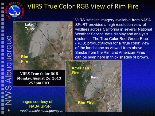
The explosive Rim Fire in California has garnered significant media attention across the world as it burns within portions of Yosemite National Park. Satellite imagery of this incident over the past few days has provided some stellar images of the wildfire smoke plume and hotspot. In particular, the Visible Infrared Imaging Radiometer Suite (VIIRS) instrument on board the Suomi National Polar-orbiting Partnership (NPP) satellite that observes the Earth and atmosphere at 22 visible and infrared wavelengths has produced several stunning images. The first image below is the VIIRS True Color RGB product showing the Rim and American Fires at 252pm PDT August 26, 2013. This imagery provides a “true color” view of the landscape as viewed from above. Smoke from these fires can be seen in thick shades of brown.
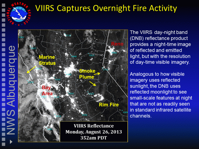
The following image is the VIIRS day-night band (DNB) Reflectance product. This imagery illustrates a night-time image of reflected and emitted light, but with the resolution of day-time visible imagery. Analogous to how visible imagery uses reflected sunlight, the DNB uses reflected moonlight to see small-scale features at night that are not as readily seen in standard infrared satellite channels.


Brian, thanks for taking the time to make this great post about the RIM Fire in CA! Even though the moon was just about half phase at the time, it still captured some of the smoke. Either the amount of smoke increased rapidly on the 26th however, or the DNB only captured some of the most reflective particles in the smoke plume. I’m tending to think it may be the latter.