


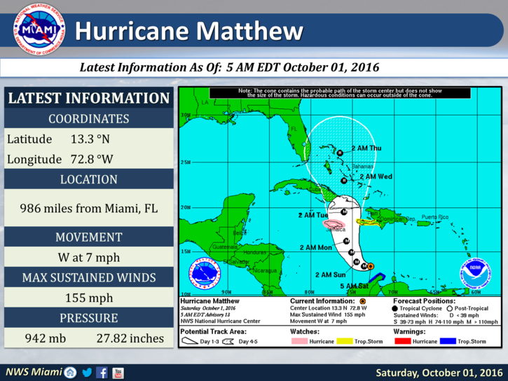
 Hurricane Matthew underwent rapid intensification late Friday and is a powerful and dangerous hurricane. At 5 am Saturday, Matthew was located near 13.3 North, 72.8 West, and had maximum sustained winds of 155 miles per hour. It was moving west at 7 miles per hour. We’re watching its track and forward motion very closely, to make sure it begins a northwest turn late Saturday or Sunday.
Jamaica is in Matthew’s path, and a hurricane watch was in effect there early on Saturday. Matthew is then forecast to move north early on Monday before reaching eastern Cuba later that day.
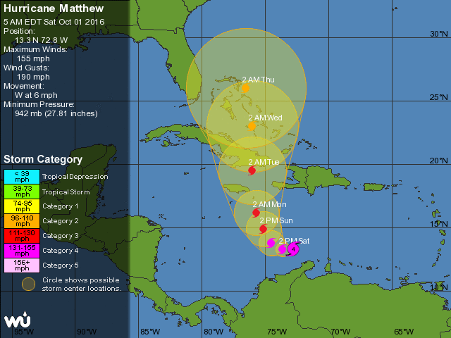 It is expected to be in or near the central Bahamas on Tuesday, with closest approach to South Florida likely to be on Wednesday. We all have to pay attention to what happens to make sure that Matthew is following the scenario. A difference of a few degrees of longitude will make a huge difference in any impacts to our area.
At this point, people in the Bahamas should begin hurricane preparations, and South Floridians need to take a look at their hurricane plans and be ready to take action on Monday if necessary.Hurricane
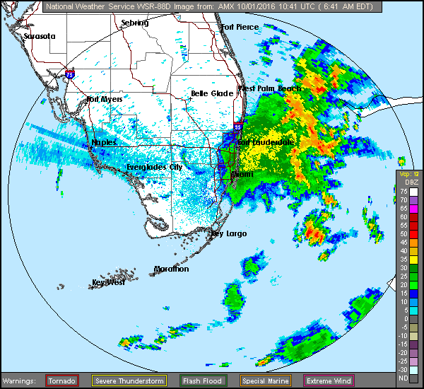 Here at home, Saturday features some east coast showers and storms, highs near 90 degrees, and developing afternoon storms, especially in western metro areas of Miami-Dade and Broward, in the interior, and along the Gulf coast.
We’ll see more showers and storms around the region on Sunday, and highs will be near 90 degrees again.
Breezes will pick up, especially along the east coast and in the Upper Keys, on Monday, and we’ll see afternoon storms pop up around South Florida. The risk of dangerous rip currents will also increase at the Atlantic beaches. Highs on Monday will be in the upper 80s.
Tuesday’s forecast will depend on Matthew’s track, but for now, look for winds to pick up and storms to blow in, especially along the east coast, along with highs in the mid to upper 80s.


