


 It’s a rainy Monday in South Florida as tropical moisture associated with Tropical Depression # 9 passes through. Fortunately, those drenching rains will be the main effect of TD # 9 as it heads into the Gulf of Mexico.
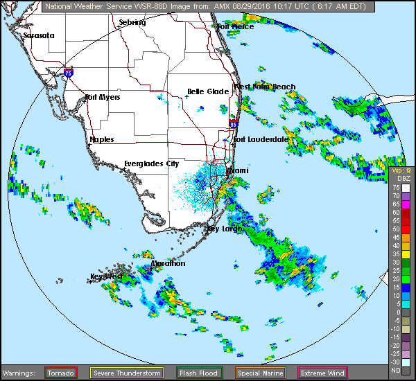
Here in South Florida, we’ll see showers and storms throughout Monday and into the night, with periods of heavy rain and gusty winds at times. The risk of dangerous rip currents will remain high at the Atlantic beaches into Wednesday, and rip current risks are increasing at the Gulf beaches. Monday’s highs will be in the upper 80s.
Tropical moisture will continue to stream in on Tuesday, and showers and storms are likely throughout the day and into the night. Localized flooding is possible. Tuesday’s highs will be in the upper 80s.
Showers and storms will pass through South Florida on Wednesday, with periods of heavy downpours, especially along the Gulf coast. Wednesday’s highs will be in the upper 80s.
We’ll begin a gradual shift to afternoon storms in Miami-Dade and Broward on Thursday, but stormy conditions will remain in the Naples area. Thursday’s highs will be near 90 degrees along the east coast and in the upper 80s in the Naples area. Look mostly afternoon storms but muggy conditions on Friday, with highs mostly in the low 90s.
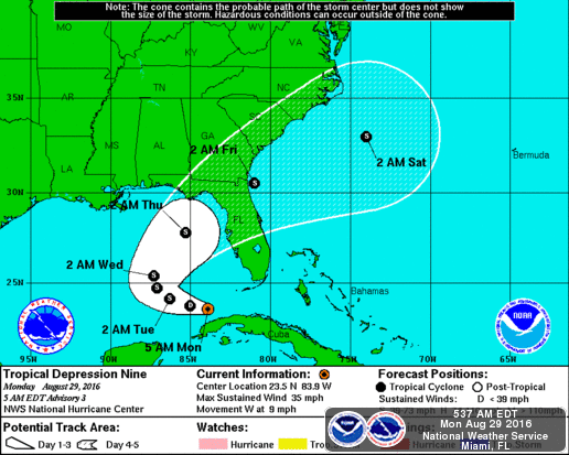 Meanwhile, Tropical Depression # 9 is moving into the Gulf of Mexico. At 5 am Monday, TD # 9 was located near 23.5 North, 83.9 West, or about 95 miles west-northwest of Havana, Cuba. TD # 9 was moving west at 9 miles per hour with maximum sustained winds at 35 miles per hour. It is forecast to become a tropical storm in a day or so and make landfall along Florida’s Gulf coast, then emerging in the Atlantic — but no watches or warnings have been issued as of early Monday.
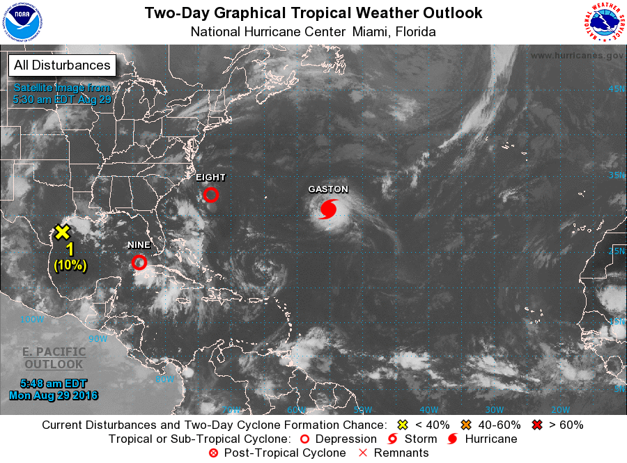 The rest of the tropics remain very busy, with Tropical Depression # 8 being of concern to North Carolina. A tropical storm watch is now in effect for parts of that state’s coast. At 5 am, TD # 8 was located near 32.6 North, 73.0 West, and was moving west-northwest at 10 miles per hour. Maximum sustained winds were 35 miles per hour, and this system is also expected to reach tropical storm strength soon. (We can’t tell yet whether TD # 8 or TD # 9 will become Hermine — with the next name on the list being Ian.)
Hurricane Gaston is nearly stalled out in the Atlantic but is not a threat to land, which is a good thing, because Gaston’s maximum sustained winds were estimated at 115 miles per hour early Monday.
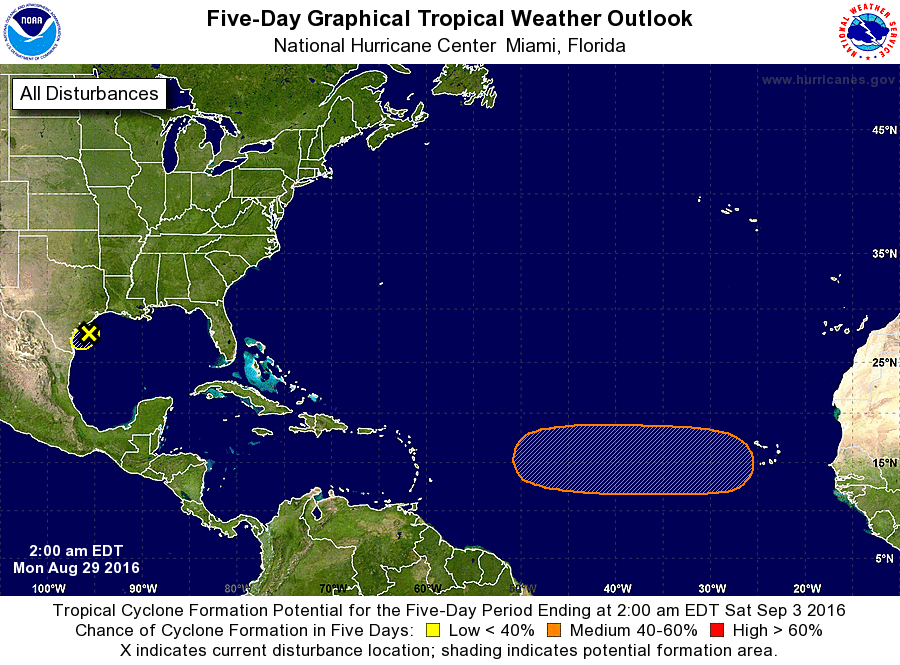 Finally, computer models forecast that a strong wave will emerge off the African coast on Tuesday and that the wave will have a medium chance of becoming the next depression by late in the week. We’ll keep an eye on that one.


