DGRI's Tim Kelly at one of the riverside trails downtown. Adam Bird
The Grand River is certainly a fixture in our community. Yet, we don't drink its water. We don't dip our feet in it. And many of us have never even stood close enough to its banks to even get wet. Now, Downtown Grand Rapids Inc. and the city of Grand Rapids aim to change our access to the river with ambitious plans for an extensive network of trails near the water.
With its namesake running north to south through the city and serving as the focal point for visitors, the Grand River is certainly a fixture in our community. Yet, we don't drink its water. We don't dip our feet in it at the dock. And many of us have never even stood close enough to its banks to even get wet. In a concerted effort to improve the river corridor, Downtown Grand Rapids, Inc. (DGRI) and the city of Grand Rapids have included a very specific plan for increased access to the water in their 10-year city improvement plan,
GR Forward, which the City Commission adopted in December 2015. A major portion of GR Forward is the development of the region's trails to run alongside the river, providing locals and visitors with a convenient way to enjoy the water year-round.
With downtown trails, "we see another great opportunity in creating transportation opportunity and economic development," says Tim Kelly, DGRI planning manager. As city leaders worked on the development of GR Forward, including the trails as part of this plan was a vital section due to the region's enthusiasm for its vast, interconnected trail network, Kelly notes. With hundreds of trails that criss-cross Michigan, connecting cities, towns, attractions and wilderness, Michigan has shown that these pathways have become a must-have for economic development and pedestrian traffic.
Though many trails enter and leave the city (The Fred Meijer White Pine Trail State Park,
Millennium Park Trails and
M6 Trail, to name a few), few actually traverse the city from end to end, leaving cyclists and runners to find their own paths on city streets. Despite the
miles of bike lanes added in GR due to the
Room to Ride Campaign of the Greater Grand Rapids Bicycle Coalition, maneuvering around the area on two wheels can still be a difficult task. In order to get trail goers through the city, and especially down to the river, Kelly and his compatriots plan to develop nine miles of trails near the water and around the city to facilitate GR becoming a hub for trail activity.
The first step to creating uninterrupted paths along both west and east sides of the river is to determine who owns each riverbank-sharing piece of land and work with them to obtain approval for trail development. Luckily, many of the pieces are city-owned, such as Canal Park. Designated as the "Coldbrook demonstration site" (due to its proximity to Coldbrook Street), the park is currently under construction and will connect the
Grand River Edges Trail from Fulton Street north through Leonard Street. This small piece of the larger trail project is designed to showcase the impact GR Forward can have on the river corridor.
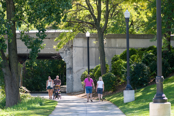
![]() People enjoy the path along the river, soon to join more trail systems. "People are excited to see that trail continue all the way to Leonard," says John Morrison, executive director of the West Michigan Trails and Greenways Coalition (WMTGC). Slated for completion in November, the Coldbrook demonstration site also gives visitors direct access to the water in a way that was previously impossible due to tall, cement walls that had served as a flood barrier. Instead, the city opted for walls lined with wire mesh and filled with rocks, which create unique steps down to the water, according to Morrison.
While sites like these can be designed and developed right away, others still require "getting creative with private developers to achieve those goals," says Kelly. Obtaining the funding, permission and unique solutions about what exactly to do with each parcel will be a time consuming endeavor for the city and DGRI. One such piece is 201 Market St., a city-owned parcel that Kelly describes as "a pretty massive site” that is currently used to house fire, police and rescue trucks.
Some sites such as these will simply require developing, while others still could possibly require cantilevers
People enjoy the path along the river, soon to join more trail systems. "People are excited to see that trail continue all the way to Leonard," says John Morrison, executive director of the West Michigan Trails and Greenways Coalition (WMTGC). Slated for completion in November, the Coldbrook demonstration site also gives visitors direct access to the water in a way that was previously impossible due to tall, cement walls that had served as a flood barrier. Instead, the city opted for walls lined with wire mesh and filled with rocks, which create unique steps down to the water, according to Morrison.
While sites like these can be designed and developed right away, others still require "getting creative with private developers to achieve those goals," says Kelly. Obtaining the funding, permission and unique solutions about what exactly to do with each parcel will be a time consuming endeavor for the city and DGRI. One such piece is 201 Market St., a city-owned parcel that Kelly describes as "a pretty massive site” that is currently used to house fire, police and rescue trucks.
Some sites such as these will simply require developing, while others still could possibly require cantilevers (structural support beams or plates) around existing structures that sit on the flood wall in order to create a pathway over the water itself. DGRI and the city are working on "finding creative ways to build the trail out," says Kelly. No matter how they go about it, the goal is to create a continuous trail along both sides of the riverbank, making the water a draw for locals and visitors in all sorts of weather.
Moving forward, DGRI will be conducting an economic impact study for GR Forward to determine the benefits of all of the moving pieces. For the trails, Kelly and others will soon work on path designs and easements on private property that they hope will become a home for the section of the pathway. Though it may be five or more years before any pieces of the trails are completed, DGRI, the city and public commentary agree that developing river corridor trails will be a big draw for GR. "This would really be a game-changing amenity for downtown," says Kelly. Excited to lend its trail expertise to the project, Morrison and WMTGC are on board. "I can't wait for it to get started," Morrison says.
This article is part of an ongoing series, Moments on the Trails, and was made possible by the West Michigan Trails & Greenways Coalition. For more information about the WMTGC, visit wmtrails.org.
Enjoy this story?
Sign up for free solutions-based reporting in your inbox each week.