
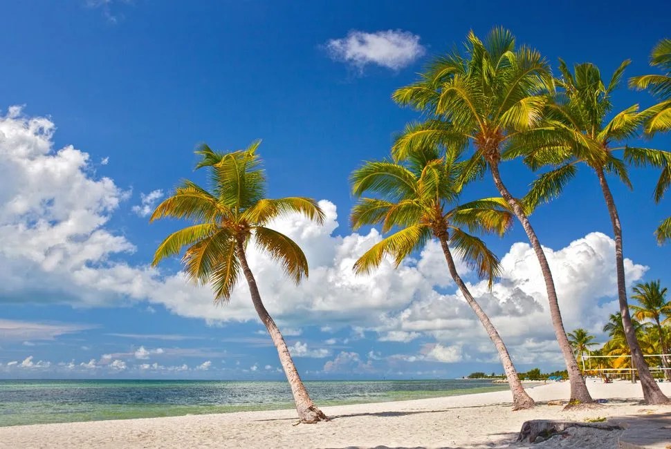
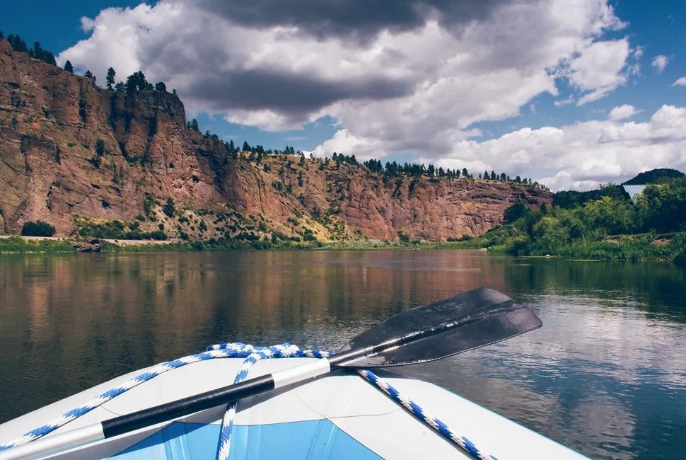
“We all understand what the spirit of adventure is”, says Alastair Humphreys, a NatGeo Adventurer of the Year and the igniting spark for the microadventure movement. “The spirit of microadventure is no different, except that it banishes all those boring real-life constraints that get in the way of us having the adventures we dream of. So a lack of time, money, expertise or gear is no longer a valid excuse.”
Microadventures, the adventures that fit into the 5:00 p.m. to 9:00 a.m. window, are overnight, day-trip or weekend adventures that don’t take excessive amounts of time or money. They also don’t take excuses. They’re the empowered times that you get outside. They’re not ascending the Himalayas or traversing the Amazon by foot. They’re waking up early on Saturday and hitting the trail. They’re returning to the shore at the end of the day for one more session of surf. They’re packing up the car after work and sport climbing limestone cliffs.
A microadventure is the combination of minimal gear — Humphreys champions “bivy bags and beer can stoves; simplicity, low cost, minimal faff and organization” — and a compact time frame to create the maximum reward for an adventurous soul. They turn an aimless Saturday of idling in the living room into a trip up a local peak, a kayak on a local body of water, a ride on the roads and trails in your own backyard.
And summer’s the perfect time to start. Long, warm days give optimal conditions to get outside and explore. Holiday weekends offer enough time to extend a microadventure to a handful of days. You know all this, though. So now it’s time to start acting. Take advantage of your surroundings. Be inspired by the small-scale trip. “America is beautiful and massive and empty and wild”, Humphreys says. “The people are generous and welcoming and friendly. There’s no excuse not to get out there.”
– Matthew Ankeny
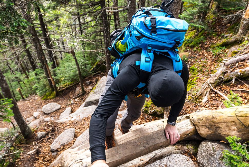
Criteria for Inclusion: We’ve picked microadventures from every corner of the United States. Some can be done in afternoon, some a weekend, and some are large enough that we’ve left it to you to break them into digestible bits. All are able to be done on a limited budget, with limited planning. Vast swaths of the US aren’t on this list, but we hope that the spirit the list conveys inspires you to think about your own place and the adventures of your own surroundings.
Motorbike the Long Beach Peninsula
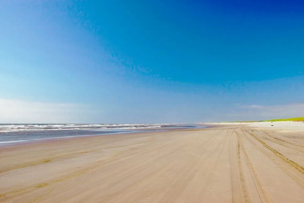 Bigstock
A Knobby Tire Playland on a Big Spit of Sand
Nestled roughly midway between Portland, OR and Seattle, WA and jutting out into the Pacific, the Long Beach Peninsula is 28 miles of uninterrupted, rideable shoreline. For motorcycle riders with knobby tires, this means at least a day’s worth of unadulterated fun as you transition from rooster tails of sand to the hardpack next to the water. Start out from Portland towards Tillamook State Forest via Route 6 and camp for the night. From there, hit the 101 and cruise into One-Eyed Willie’s backyard to enjoy a post-ride pint at Rogue Ales Public House. The treasured sand lies just across North America’s longest continuous truss bridge, the Astoria-Megler Bridge, where the Peninsula awaits. If you time it right (August 1st weekend), you can even take in the Castle Rock TT flat track race on your way back into PDX. – Matt Neundorf
7 Breweries to Visit in Portland | Map
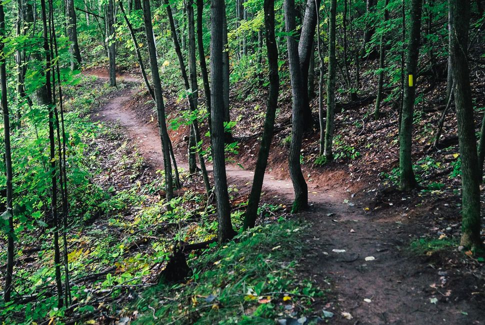
Mountain Bike in Stowe, Vermont
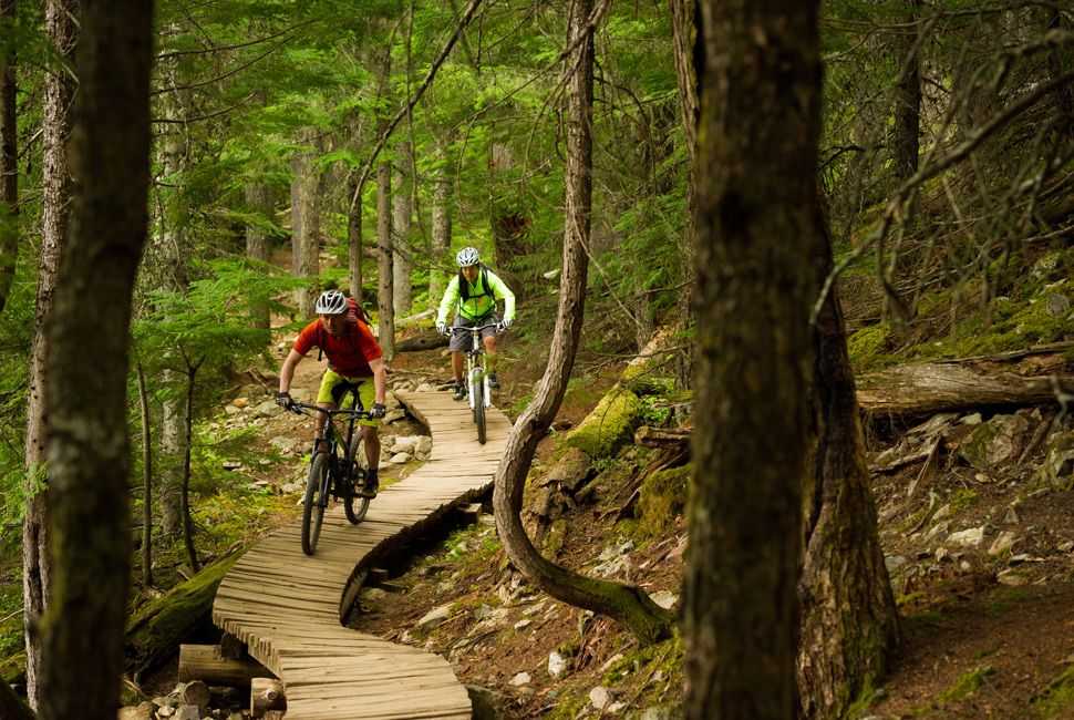 MIKE CRANE
A Winter Destination Offers Equal Attraction Come Summer
Often seen as a winter destination, Stowe, VT offers some of the best mountain biking in the Northeast. Located within the Cady Hill Forest, the Stowe Town Loops offer trails for every level of riding. Filled with boardwalks, bridging, and many natural features, the trails supply more than two hours worth of riding. This Green Mountain gem is beloved for its limited elevation, which provides an exciting high-speed-flowing single track. Access to the blue, yellow, and red routes can be found from AJ’s Sporting Goods. The prime riding season starts in the summer, but extends well into the fall. – Chase Pellerin
The Best Bike Racks for Your Ride | Map
Fall Rock Climbing in the Gunks
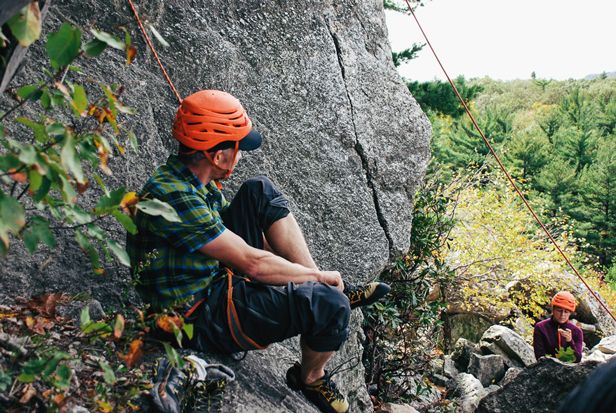
New Paltz, NY: Fall is the best time to climb in the Gunks. Temperatures are mild, and rain falls infrequently. More importantly, though, it’s peak foliage season, and the treetops are licked by the red and yellow flames of Mother Nature’s annual fireworks display. Later, atop Han’s Yellow Face (5.6 PG), lead climber Freddie Wilkinson points to the southern horizon, beyond the Shawangunk Ridge to where you can almost make out the glass-and-concrete canyons of Manhattan. – Peter Koch
Canyoneering in the Kadunce
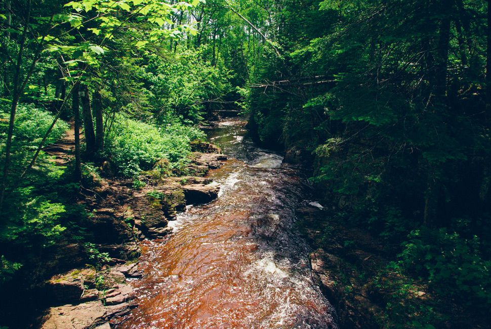
Taking a Full-Immersion Approach to Hiking the Superior Trail
The Superior Hiking Trail threads a world-class route up the north shore of Lake Superior, but if you want to get off the beaten path, you’ve got to get your feet wet. The shore is teeming with rivers that cascade down to the big lake, and hiking up the picturesque Kadunce on a hot summer day can be both cooling and exhilarating. Park right at the lakeside parking lot north of Grand Marais and head up the river. It’s no use stepping from stone to stone; you’re going to get wet, so just wade right up the river. This is no easy walk though. You’ll need to climb up several waterfalls or bushwhack to traverse them. The steep canyon walls lend an isolated feel to the excursion, but they also mean once you’re upriver, you’re committed to the whole hike. When you get to the bridge where the Superior Hiking Trail crosses over the river, you can climb out and head back down to your car on the trail, feet sloshing the whole way. When you’re done, you can make it for high tea at the 1920s-era Naniboujou Lodge. Just change into dry clothes before you go in. – Jason Heaton
The Best Hiking Shirts for a Full Day on the Trail | Map
Surf Malibu, Mountain Bike Big Bear
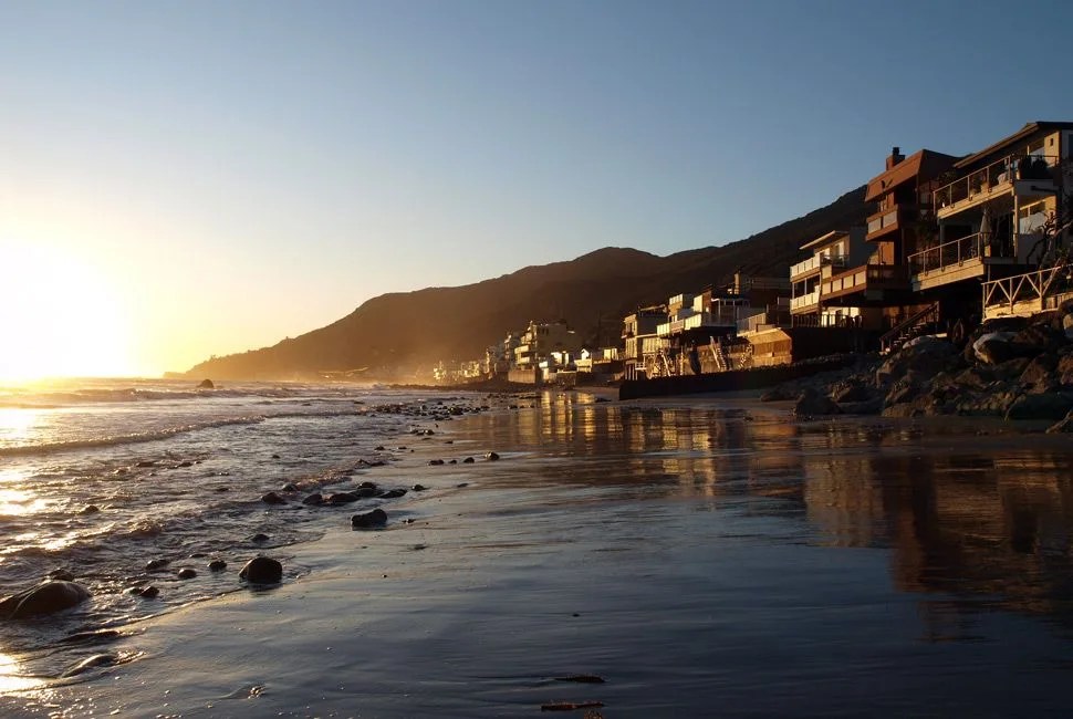 Bigstock
The Patented Los Angeles Surf & Turf
For the non-locals, start off a little luxe. Get a good night’s sleep in the Egyptian cotton sheets of the warm and modern Shore Hotel, located in Santa Monica and overlooking the ocean. Then, wake up early for dawn patrol and load up your boards and bikes. Head a few miles north on the famous PCH to Malibu’s Zuma Beach. After a morning of brisk water and solid swells, take the beautiful, twisting Malibu canyon through the hills. Stop for a hearty breakfast and grab a coffee, serenaded by Ducattis and Harleys at The Rock Store, then continue onward, hitting the 101 and a few other freeways until a touch over two hours later you’re at Big Bear Mountain. You can take the lifts up for some mountain biking, or stop in a local shop and ask for the good trails. Stay in Big Bear that night, and do the inverse the next morning — ride in the morning, then get down the mountain for an evening surf session. – Bradley Hasemeyer
Hunting LA’s Best Burgers | Map
Climb at Rifle State Park
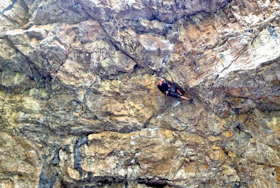
A Day Climbing With the Local Pros
Every climber on the Colorado Front Range can tell you: Rifle Mountain Park is where the pros go. Located off I-70 just west of Glenwood Springs, the climbing happens back in a narrow riparian mountain canyon with steep limestone walls. With an unprecedented amount of 5.13-to-5.14 sport routes, the park has been credited with the “best limestone sport climbing in North America”. Grab a guidebook and pack the truck with plenty of chalk and beer, then stay the whole weekend camping along the creek, where you can cool your hands at Rifle Falls. – Whitney James
Beginner Rock Climbing Essentials | Map | Photo: Glenwood Climbing Guides
Not Limestone, But Lots of Sand
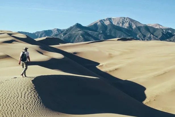
Great Sand Dunes: Going to Great Sand Dunes National Park in southern Colorado is more than a camping trip. Like a trip to the beach when you’re young, it is freedom. Part of that is because it’s a place where anything goes, where you do stuff you can’t in any other environment. The desert-like terrain was formed by wind picking up and moving sand sediments from the Rio Grande River. Where the wind died, the dunes began. Traditional hikes and trails point you on a path, and even if you want to diverge from that path, obstacles stand in your way. Cliffs. Boulders. Fallen trees. Rivers. But amongst the sand dunes of the park, any direction — literally any way you want to go — is up for grabs, all 360 degrees of space. – Will McGough
Paddle the Apostle Islands Sea Caves
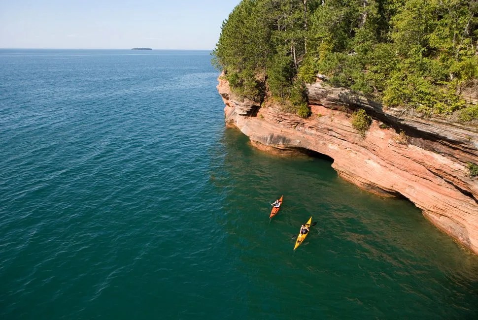
Dipping the Paddle on the Largest Freshwater Lake in the World
Lake Superior is the largest freshwater lake in the world, a true inland sea, and its coastline is peppered with islands and inlets ripe for exploring from a kayak. The 21 Apostle Islands make up a designated National Lakeshore, their shores and surrounding waters perfect for camping, hiking and shipwreck-hunting throughout the summer. Bayfield, Wisconsin is your jumping-off point and local outfitter Trek and Trail leads guided paddles daily, from the dramatic sea caves carved out by the pounding waves to multi-day kayak camping on the outer islands. After a day of paddling, rent a cabin from Bayfield Inn and cook your own freshly caught lake trout, or head over to the modern Wild Rice Restaurant for haute cuisine. – Jason Heaton
Reward Yourself With a Local Beer | Map
Kayaking from Cold Spring, New York
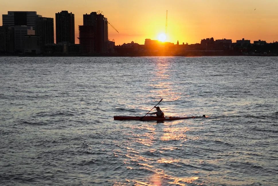
Take the River Down to Manhattan
Cold Spring is a quaint town in upstate New York. It sits on the Hudson River about an hour-and-half train ride (tickets, $14) from NYC. If you have an inflatable SUP or a foldable kayak, like the Oru Kayak, you can take an early train up north, boat in hand. When you get there, stop at Cupoccino Cafe for a quick coffee and pastries, then start your journey down the river. Stay close to the shoreline, and pay attention to the current. The timing of the 56-to-60-mile trip depends on the current, and it could end up being an 8-to-12-hour journey, so pack up water, food and the right gear for the journey. – Sung Han
Stowable Boats for the (Adventurous) City Slicker | Map
Mountain Bike the Whole Enchilada
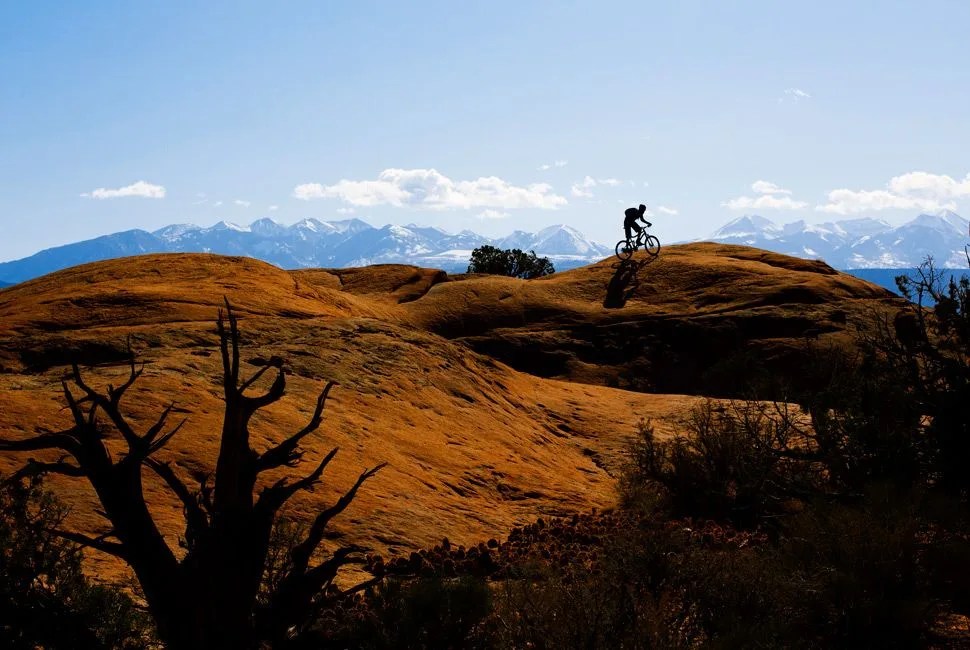 Gibsonpictures.com
Traversing the Full Bounty of Utah’s Best Mountain Bike Trail
Any trail named after a Mexican dish is bound to be a good one, and the Whole Enchilada in Moab, UT is no exception. The 26.5-mile epic begins at 10,400 feet at Burro Pass in the La Sal Mountains, which is only accessible early summer through early fall. The single track tilts steadily downhill for 7,000 vertical feet through several types of classic Utah terrain, from alpine forests to desert slick rock. To get to the trailhead, grab a cash-only shuttle at Poison Spider downtown. Reap the rewards all afternoon before popping out onto the shore of the Colorado River past the famous Porcupine Rim. Afterwards, squeeze into Miguel’s Baja Grill for a celebratory margarita and, naturally, the enchiladas. – Whitney James
Nearby Notable: Bluff, UT
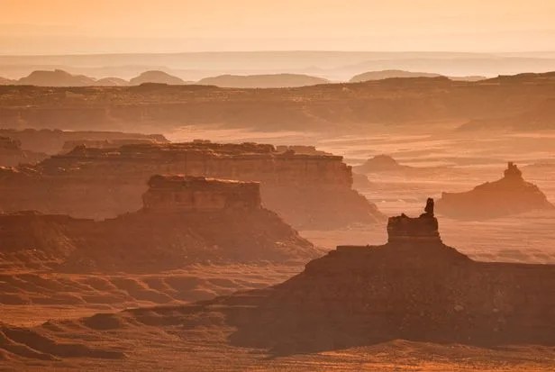
Grand Gultch: Picture Monument Valley but without the crowds. Same huge sandstone buttes, sweeping desert mesas, domed blue sky. Plus hundreds of hike-able canyons strewn with 1,000-year-old Anasazi ruins you can climb right into. And it’s just an hour from tourist-saturated Monument Valley. – John O’Connor
Scuba Wazee Lake
Exploring the Mysterious Corners of a Flooded Mine Pit
Living inland is no excuse to not go scuba diving. Though lake diving can often be a murky, weedy affair, flooded mine pits and quarries often are as clear as the Caribbean and offer interesting underwater topography. At 350 feet deep, Wazee Lake in central Wisconsin is the deepest one in the state and often used as training ground for technical divers before they head to the wrecks of the Great Lakes. Once mined for iron ore, Wazee was left to fill up with water in the 1980s and the flooded 146-acre pit still contains a ghostly underwater forest of trees, huge boulders, abandoned mining machinery and a switchback roadway that spirals down into the deep. Along the way, there are plenty of bass and walleye to keep you company, and when you’re ready for a surface interval, there’s even a sandy beach at one end of the lake. The water is cold most of the year though, so wear a thick diving suit. Black River Falls is the nearest town and the Falls Motel is a clean, old-fashioned motel perfect for some quiet decompression time. – Jason Heaton
Bring an Underwater Camera to Capture the Moment | Map
Backpack the Ice Age Trail
Discovering History and Open Vistas on an Ancient Trail
Spanning nearly 1,200 miles from the northwestern region of Wisconsin all the way to the shore of Lake Michigan, the Ice Age Trail follows a terminal moraine formed during the last Ice Age. Along the way you’ll be surrounded by forests and glacial formations, including kettles, eskers and erratics. And, if you were always a fan of scavenger hunts as a kid, you can even partake in “geochaching” along the way. You’ll have your pick of backpacking sites ranging from the minimal “primitive” sites along the northern portion to the more developed adirondack shelters. Obviously you can’t traverse it all in one go, but with all that trail and glacial beauty, you’ll have plenty of routes to choose from. – Andrew Connor
Best Backpacking Boots for a Really Long Walk | Map | Photo: Ice Age Trail Alliance
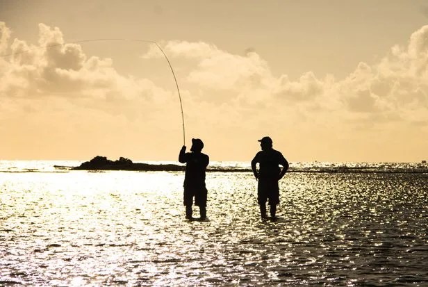
Fly Fish Montana’s Blackfoot River
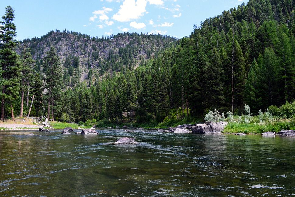
Cast Away on One of America’s Iconic Rivers
Running nearly 150 miles from Montana’s Continental Divide to the Clark Fork River, the Blackfoot River is arguably fly fishing’s most revered destination. It was the star attraction in Norman Maclean’s novel A River Runs Through It, and today, all kinds of trout — Westslope Cutthroat, Bull, Rainbow, Brown and Brook — swim in its snow-fed waters. If you’re coming in from out of town, hiring an angling guide like Blackfoot River Outfitters is the best route to take. They’ll take you camping along the river, and you’ll be shown the river’s secret spots. – Tucker Bowe
What to Wear While On the Blackfoot | Map
While In the Area, Climb Grand Teton
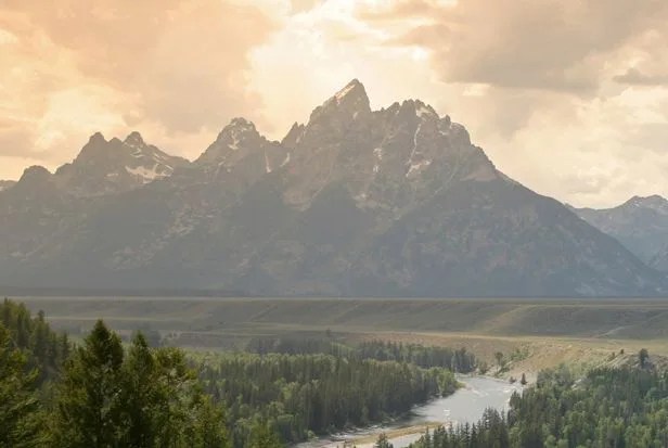
Grand Teton: In a notch between the Grand Teton and its little brother, Middle Teton, sits the Exum Hut, a lonely wood-and-rubberized-canvas base camp surrounded by alpine tundra and glacially deposited boulders. It was here that I could finally drop my pack after an epic seven-mile, 5,000-foot approach hike. I threw on warm down layers to cut the chill and then watched the sun set over Teton National Park. I made small talk with a dozen or so other climbers and guides from all over the country who, like me, were buzzing with anticipation and nervousness for the impending 1:00 a.m. wake-up and summit bid. – Will Cockrell
Ride the Lake Superior Loop
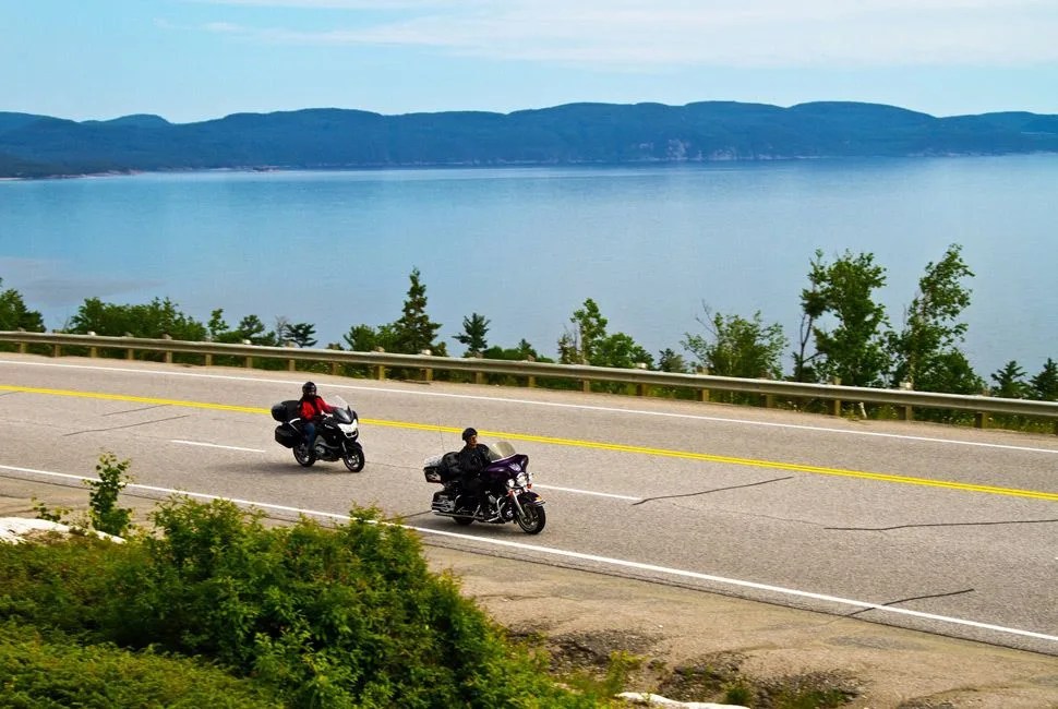
Letting the Bike Rip on 1,450 Miles of Paved Curves
With 1,450 miles of winding coastal roads to enjoy, the Lake Superior Loop is a bucket list ride for everyone addicted to having their knees in the breeze. Passing through the northern parts of Michigan, Wisconsin, Minnesota and Ontario, Canada, there is an immeasurable amount of worthy distractions along the way. Pack a tent, sleeping pad and bag, leave pretension in your garage, hop on your bike and just ride. – Matt Neundorf
Best Touring Motorcycles for the Long Haul | Map
Hike the 6’ers of Appalachia
Taking on the Many Peaks of the Black Mountains
Having too many mountains to hike is always a good problem to have — especially when you find yourself in the Black Mountains of southern Appalachia, with over 50 peaks that break 6,000 feet. Your best bet is to shack up in the mountain city of Asheville, North Carolina while you mull over your hiking options. All the 6’ers are only about an hour’s drive from the city center, so if you’re feeling really ambitious you might be able to hit multiple peaks in a day and still make it back in time for a solid dinner at Isa’s Bistro. – Bryan Campbell
15 More Hikes to Hit in the South | Map
Gig for Flounder in Savannah
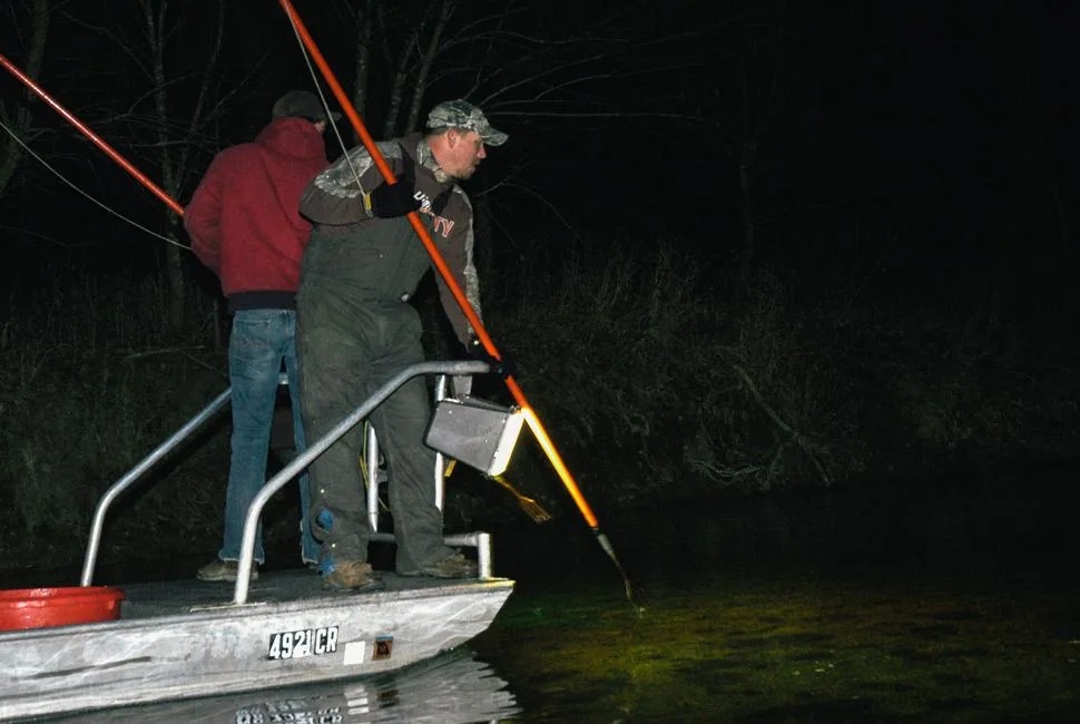
Because Adventure Doesn’t Stop When the Sun Goes Down
Gigging flounder combines the best of hunting and fishing: you wade or float over the marsh flats of the Savannah River (just outside the city limits) at night, lighting the bottom and looking for the telltale eyes of flounders buried in the sand. Then it’s just a stab of the spear (and a potential fight, if it’s a big one), and you’ve caught your breakfast. If you don’t have a boat or a flounder gig, go with a pro, like the ones at Starling Adventures, who will have all the gear and expertise you’ll need. – Chris Wright
The Complete Guide to Fishing 8 American Cities | Map
Head Farther South for Bonefish
Culebra: The island, an arcing cradle of earth lying 17 miles east of mainland Puerto Rico, is one of the last Caribbean backwaters and one of the most highly regarded bonefishing locales. Small, brightly colored houses dot the shrubby hillsides. Docks jut into the water this way and that like rows of crooked teeth. Above them, the façade of a luxury hotel gleams ominously. As the little fiberglass craft streaks into the bay, I get a sense that the island exists between two epochs, rooted at once in its humble past while being dragged into a future of development and eco-tourism. – J.W. Sotak
Ride the Great Smoky Mountains
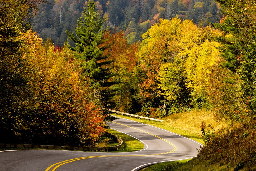 Bigstock
Rising Early for Riding on One of America’s Greastest Roads
There are 318 curves contracted into a mere 11 miles of two-lane blacktop writhing through the Great Smoky Mountains. Better known as the Tail of the Dragon, this seemingly infinite series of switchbacks along US 129 remains one of America’s most challenging places to push limits on two wheels or four. Your best bet for avoiding a parade route’s pace (and increased law enforcement) is to get up early and start attacking before your fellow parishioners fire their engines. If the thought of competing for corners doesn’t appeal to you, head along US 28 to the east of Deal’s Gap or US 143 towards Huckleberry Knob for equally fantastic — and mostly empty — technical tarmac. As an added bonus, there are limitless hiking trails in the area, if you’ve still got some energy. – Matt Neundorf
The Alternative Plan to the Smoky Mountains | Map
Dive Key West
 Bigstock
Exploring the Coral Cays of the Continental US
Considering the Continental US’ southernmost bits are comprised of a collection of coral cays, it should be no surprise that the scuba diving is epic in the Florida Keys. Head all the way down to Key West and both those new to open water and Plonguers Professionnels can explore the warm waters below. Things get interesting a mere 20 feet below surface along the Marquesas Reef Line and become incredible from there. Wreck divers are spoiled for choice as Joe’s Tug, the Cayman Salvager and the USS Wilkes Barre are all a charter away. Ten Fathom Ledge and Ten Fathom Bar offer incredible reef walls and cave exploration for those looking to push limits. It’s no wonder that Fabien Cousteau chose this spot for his Mission 31.– Matt Neundorf
Make Sure There’s a Solid Dive Watch on Your Wrist | Map
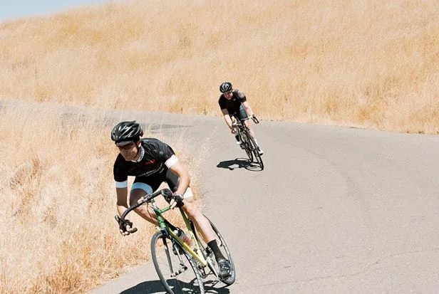
Cycle Monterey to Cambria
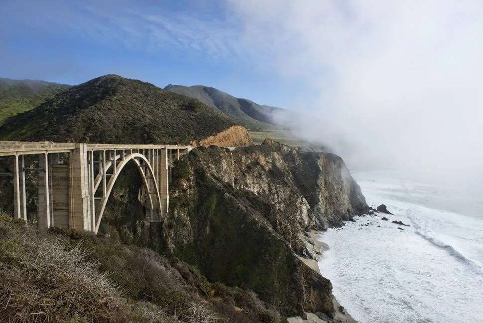 Bigstock
Riding on 100 Miles of Golden Coast
Riding doesn’t get better than this — 100 miles, 8,500 feet of climbing, all on razor-edge cliffs over the Pacific. Camp out in Monterey at Veteran’s Memorial Park, then hit the trail before daylight. It’s a straight shot south on PCH, and if your legs don’t quit, you’ll land in Cambria. If you have a generous friend, have them trail you in a quasi-sag car, then meet up at San Simeon, shower, get protein at Main Street Grill, then camp out for the night. Still got legs? Ride back north the next day. – Matthew Ankeny
The Climb, the Coast and 103 Miles to Burn | Map
Inland Flavor for More Scenic Cycling
Sonoma County: Sonoma County, CA is one of those places that you visit and then go home scratching your head over, wondering why you still live in cloudy, cold Buffalo, NY. With around 300 days of sun per year and temperatures hovering in that sweet spot between 50 and 80 degrees Fahrenheit, the weather alone makes this place a quasi paradise. Then there’s the coast, the redwoods, the Zinfandels — and, for our purposes, the cycling. – Jeremy Berger
Ride the Winds of Cape Hatteras
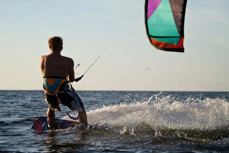
Empowered by the Wind and Driven to Adventure
Cape Hatteras is one of the premier watersport destinations in the world. It’s the annual home to the Triple-S kiteboarding tournament, and its winds and waves are always pumping. For those looking to get their feet wet, Cape Hatteras Kiteboarding will set beginners up with gear and lessons. Or, if you’re a traditionalist, there’s plenty of good sailing. If you’re not exhausted from a day on the water, head an hour north to Kitty Hawk. Along with being the site of the Wright Brothers’ first flight, it’s also home to the largest hang-gliding school in the world. – Tucker Bowe
A Kiteboarding Primer to Get Your Feet Wet | Map | Photo: Real Watersports
Traverse the Missouri River
 Bigstock
Moving Downstream on the Heartland’s Great River
If you’re a lover of all things aquatic, do as Scott Mestrezat did and take advantage of the USA’s longest waterway. Go by stand-up paddle board if you like a challenge — or if you haven’t been keeping up on your tai chi and are lacking balance, a kayak will do nicely. Mestrezat’s 2,400-mile journey took 107 days to complete, but if you don’t have a third of your year to dedicate to the journey, try paddling your way between any of the two of the many populated areas along the river; for example, Omaha to Kansas City takes a week at most. – Andrew Connor
The Best Waterproof Smartphone Cases | TRIP Map
Hike the White Mountains
Hut to Hut Hiking Is the Right Amount of Luxe
If you like having a roof over your head but hate the thought of glamping, the eight backcountry huts in New Hampshire’s White Mountain National Forest are your jam. Operated by the Appalachian Mountain Club and located along the New Hampshire portion of the Appalachian Trail, the huts range in elevation from 2,760 feet at Lonesome Lake to 5,012 feet at Lake of the Clouds. Since they’re located one day hike apart from each other, you can crash for a night in their modest bunk rooms or take nine days to hit all of the huts; either way, you only need a daypack because the freshly baked bread and family-style meals served at breakfast and dinner are as hearty and spectacular as the views of the Pemigewasset Wilderness. – Jeremy Berger
Best Dehydrated Meals for Life on the Trail | MapS
Going International, and Without the Hut
Swiss Alps: We’d go backpacking, in the Alps — no huts. Bring your sleeping bags and bivy sacks, he said. Brilliant, I thought. No huts meant not sharing a bunk room with 12 other people, which meant no waking up in the night listening to strangers snore, no breathing the humid international farts of those strangers, no one getting up at 3 a.m. to use the bathroom and making noise as they exited and re-entered the bunk room. We would save $78 per person per night; my inner dirtbag rejoiced. We could make whatever food we wanted for dinner, and for breakfast, and most importantly, we could sleep anywhere we wanted. We would simply roll our sleeping bags out somewhere with an incredible view and go to sleep with the stars just above our heads. – Brendan Leonard
Camp Along the Shore in Acadia National Park
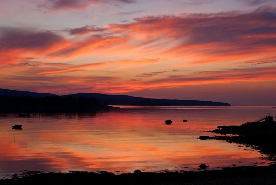 Bigstock
Catching the First Light that Touches the USA
Getting up for sunrise is always worth the effort, but being the first of 318+ million Americans to see the sunrise? Now that’s an accomplishment. Maine’s Acadia National Park puts you at one of the most easterly points in the United States and makes for great front-row seats to the start of a new day. Camp out in the park, and once the sun is up, enjoy miles of great coastal trails. If you want some civilization, head into Bar Harbor (which shares acreage with the national park) and you’ll quickly realize why the town was originally dubbed Eden. – Bryan Campbell
If You Want Maine Lobster, Join This Crew | Map
Climb Mount Marcy, NY
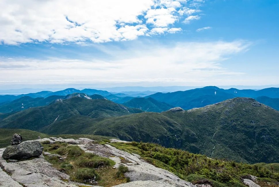
Summiting the Highest Point in New York State
As the tallest peak in the Adirondacks, Mount Marcy lies seven miles from the nearest trailhead, and the best route to it can be quite the journey in its own right. Due to fickle weather, the peak is often covered with snow between October and May, so be prepared for any climate when climbing. Set up reservations at the Adirondack Loj — 8 miles south of Lake Placid, NY. Early the next morning arrive at Trail 61 of the Van Hoevenberg Trail and begin the 7.4-mile trip to the summit. With an early start and a steady climb, the trip to the top can be done in a day, and the view from the peak includes 43 of the 46 major peaks in the park. Packing accordingly and avoiding poor weather, you’ll enjoy a healthy 14.8-mile round trip.– Chase Pellerin
Get a Bottle of Local Wine for a Celebratory Toast | Map | Photo: Abhishek Srivastava
Hike Washington’s Olympic Peninsula
 Bigstock
A Long Walk on America’s Most Isolated Beach
The South Coast Wilderness trail offers 17 miles of beach hiking, along with 3,000 feet of elevation change. It’s good for a strong hike over a long weekend. Leave a car at the Oil City trailhead, then drive up the the start at La Push, and be sure to bring a tide calendar (along with everything else you’ll need for a two day hike). The coast offers plenty of diverse terrain, from sandy beach hiking to rope ladder climbs. Sea stacks dot the coast, and it’s one of the most isolated, pristine and scenic places you’ll see in the contiguous US.– Matthew Ankeny
A Primer on Ultralight Backpacking | Map
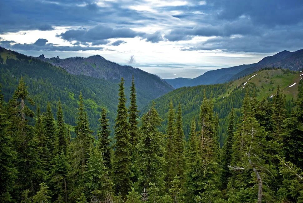
Exploring the Harsh Beauty of the Cascades
North Cascades: The North Cascades, one of the least-visited national parks in the country, abuts Washington’s border with British Columbia, a mere two-and-a-half hours from downtown Seattle. So why doesn’t anybody go? Well, the North Cascades aren’t exactly user-friendly. There are no drive-up views for the minivan crowd. Plush lodges and charming hamlets are few and far between. Stray kids looking for a gift shop might get swallowed by a patch of thorny devil’s club. The price of entry is almost always steep (literally). Rangers usually spend a lot of time telling you what a miserable time you’ll have if you put yourself at the mercy of the park’s capricious and violent weather. But they just want it for themselves. – Ted Alvarez
Fastpack the Devil’s Path
Your Best Chance at Summiting Six Peaks in a Short Stretch
The Devil’s Path lives up to its name. Located in New York’s Catskills State Park, it’s universally regarded as one of the most challenging hikes in America. Winding approximately 25 miles and rising/falling 14,000 feet, hikers have the option to pick their poison: one of six peaks to summit. Each trail forces hikers to climb over 2,000 feet and use their hands almost as much as their feet. But it’s not all rough and tumble; once you’re at the top, each peak boasts spectacular views out over the state park. You won’t need a guide here, but a map, a friend and food and water rations are vital. – Tucker Bowe
10 Best Daypacks for Every Adventure | Map
Cycle New Jersey’s Pine Barrens
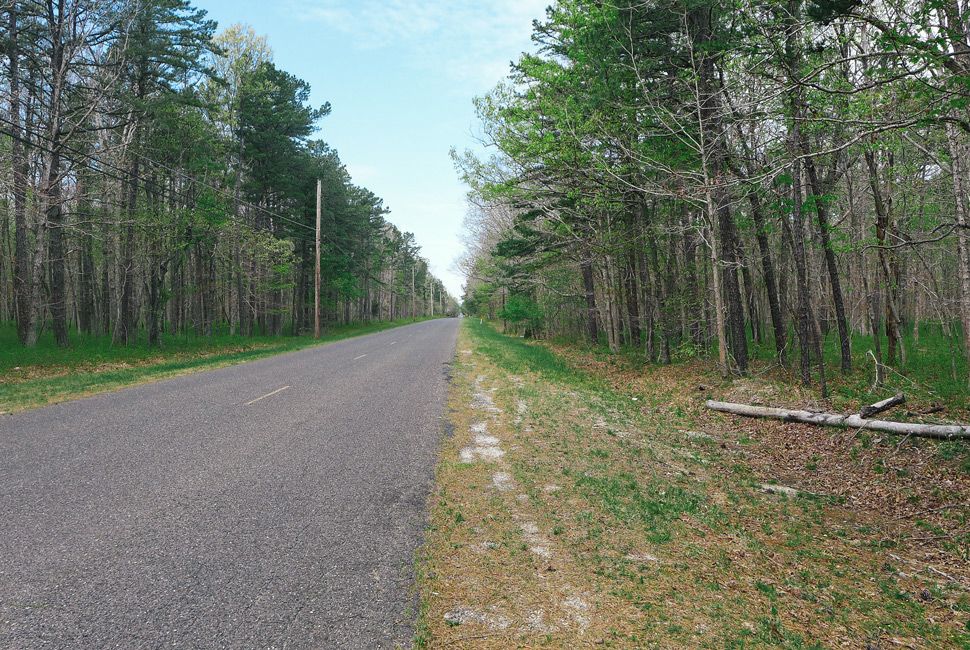
From Gangsters to Bucolic Trails, a Nearby Cycling Secret
A vast, protected landmass, the Pinelands (often called the “Pine Barrens”) became the nation’s first National Reserve in 1978 thanks to its unique ecosystem of rare plants and wildlife. With miles of flat, quiet roads between both New York City and Philly, the area became infamous in the early 20th century as a place where gangsters would come to drop bodies. Today, however, those same back roads are an open secret among cyclists of the Northeast as home to one of the region’s best spots to ride. Plan an overnight around Wharton State Forest in the heart of the Pinelands. Arrive early and set up camp at Atsion Campground ($3 per night) before making your way onto the “Heart of the Pines Cycle Route”, a quiet 51-mile loop around Wharton on pristine paved roads. – Jack Seemer
A Stable of Worthy Steeds to Complete the Ride | Map
Producer: Matthew Ankeny. Edited by: Nick Milanes. Writers: Matthew Ankeny, Jeremy Berger, Tucker Bowe, Bryan Campbell, Andrew Connor, Bradley Hasemeyer, Sung Han, Jason Heaton, Whitney James, Matt Neundorf, Chase Pellerin, Jack Seemer, Chris Wright.