At a Glance
- A tropical disturbance in the eastern Atlantic Ocean is likely to become a tropical depression or storm on Wednesday.
- It is too soon to determine whether this would ever affect the Lesser Antilles next week.
- However, forecast trends suggest it is more likely to remain north of the Leeward Islands.
A tropical disturbance in the eastern Atlantic Ocean is likely to develop into the Atlantic hurricane season's next tropical depression or storm on Wednesday.
(MORE: Hurricane Central)
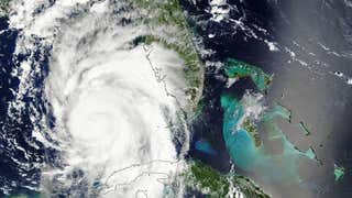
Invest 98-L is a tropical wave, an area of low pressure without a closed, counterclockwise surface circulation several hundred miles southwest of the Cabo Verde Islands off the west coast of Africa.
(MORE: What is an Invest?)

This tropical wave emerged off the west African coast this past weekend, and continues to flare some convection, albeit still a bit disorganized, according to infrared satellite imagery.
(MORE: Why Tropical Waves Are Important During the Hurricane Season)
For a tropical cyclone to form, you need persistent convection near a surface low-pressure circulation.
While neither of those conditions have been met yet, the National Hurricane Center says this system has a high chance of development into a tropical depression or tropical storm over the next 48 hours.
Invest 98-L will continue tracking west-northwest to northwest the next few days in the open eastern Atlantic Ocean. For now, this system is no immediate threat to the Lesser Antilles, as it is over 2,000 miles away.
(MORE: Three Things to Know About Spaghetti Model Forecasts)

Even if Invest 98-L does develop into a tropical depression or storm - the next named storm would be called "Fiona" - it faces a familiar pair of nemeses later in the week.
First, the system is expected to face increased wind shear, namely, differing winds aloft compared to near the surface, roughly near or just the halfway point between Africa and the Lesser Antilles.

Wind shear tends to displace a tropical system's convection from its center of circulation and can also tilt that circulation. While some intense hurricanes can fend off some light to moderate wind shear, weaker systems can be ripped apart if the shear is too strong.
(MORE: Hurricane Season Outlook Update)
The increased southwest winds aloft responsible for the anticipated wind shear, along with a fairly weak Bermuda-Azores high may also help to draw the system more northwest later this week, eventually gaining too much latitude to ever be a threat to the Lesser Antilles.

Dry air in the central Atlantic later in the week could also wrap into the system, encouraging stronger thunderstorm downdrafts and dispersing the convection from the system's center.

Again, this system is not a threat to the Windward and Leeward Islands at this time.
Assuming it develops, it wouldn't make it to the longitude of these islands until early-mid next week, if it ever does, and appears likely to be pulled well north of that as discussed above.
However, this is another sign that we're headed into the climatologically most active time of the Atlantic hurricane season.
(MORE: When Atlantic Season Peak Arrives)
This time of year, you can see tropical waves, also known as African easterly waves, lined up over Africa south of the Sahara Desert, ready to emerge into the eastern Atlantic Ocean.
A fraction of these tropical waves serve as the seed for an Atlantic basin tropical storm or hurricane each season.

So, while Invest 98-L may not pose a significant threat to land, that may not be the case with subsequent tropical waves in the heart of the hurricane season.
Check back with us at weather.com for the latest on this system and any other systems during the hurricane season.
Jonathan Erdman is a senior meteorologist at weather.com and has been an incurable weather geek since a tornado narrowly missed his childhood home in Wisconsin at age 7.
MORE ON WEATHER.COM: Retired Atlantic Hurricane Names