After the Civil War in 1785 president Thomas Jefferson established a grid-system in order to allocate the American West. This so called Thomas Jefferson Grid was made by superimposing a rectangular grid on the earth surface, a grid built from exact square miles.
Since a round earth does not lend itself to a repeating network of equal-sized squares, the checkerboard of roads is fractionally shifted.
Take a square piece of paper, wrap it around an orange and observe the tapering folds in the paper, If you want to cover the earth with checkerboards, you can only do so if you outsmart the folds in the paper.
The system has to be corrected in order to continue as though nothing has been corrected.
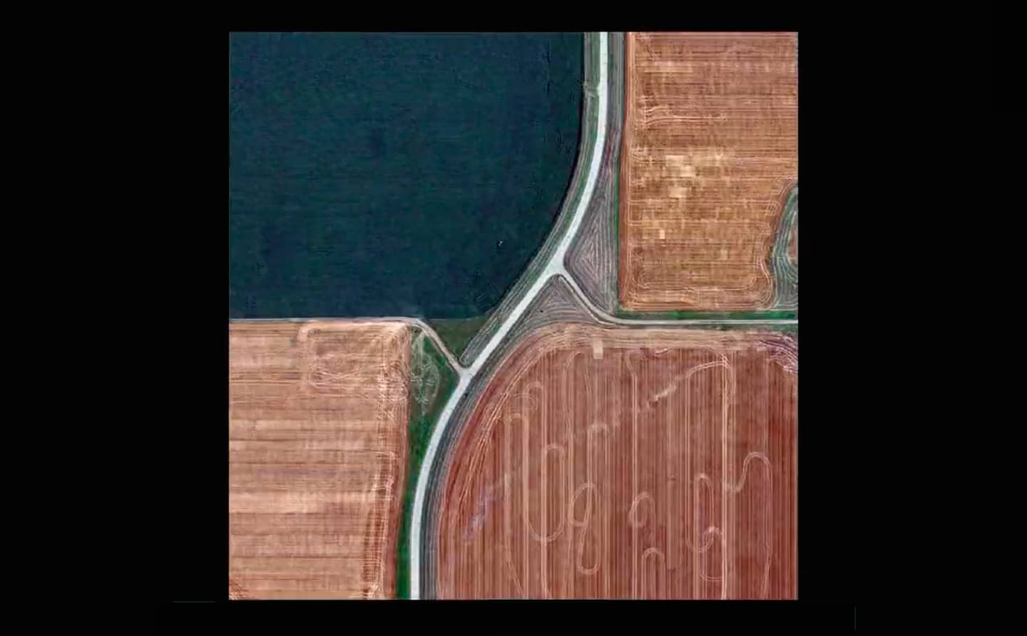
The north-south boundaries in the grid are on the lines of longitude, which converge to the north. The roads that follow these boundaries must dogleg every twenty-four miles to counter the diminishing distances: It is easy to see in Google Earth how these repeated corrections have produced fascinating crossroads: T-Junctions, straight or curved, and always inventive.
Gerco de Ruijter collected hundreds of these corrections and created the stop-motion film Grid Corrections.
The film shows in a dazzling way how man has tried to exert control over the earth. Nature may seem stronger than humanity, but at the same time humans constantly manage to overcome nature with their boundless inventiveness.
This is the extended version of the original film released in 2016
Grid Corrections (The Book) is published by nai010
nai010.com/nl/publicaties/gerco-de-ruijter-grid-corrections/240707
Made possible with the generous support of the Mondrian Fund, Amsterdam